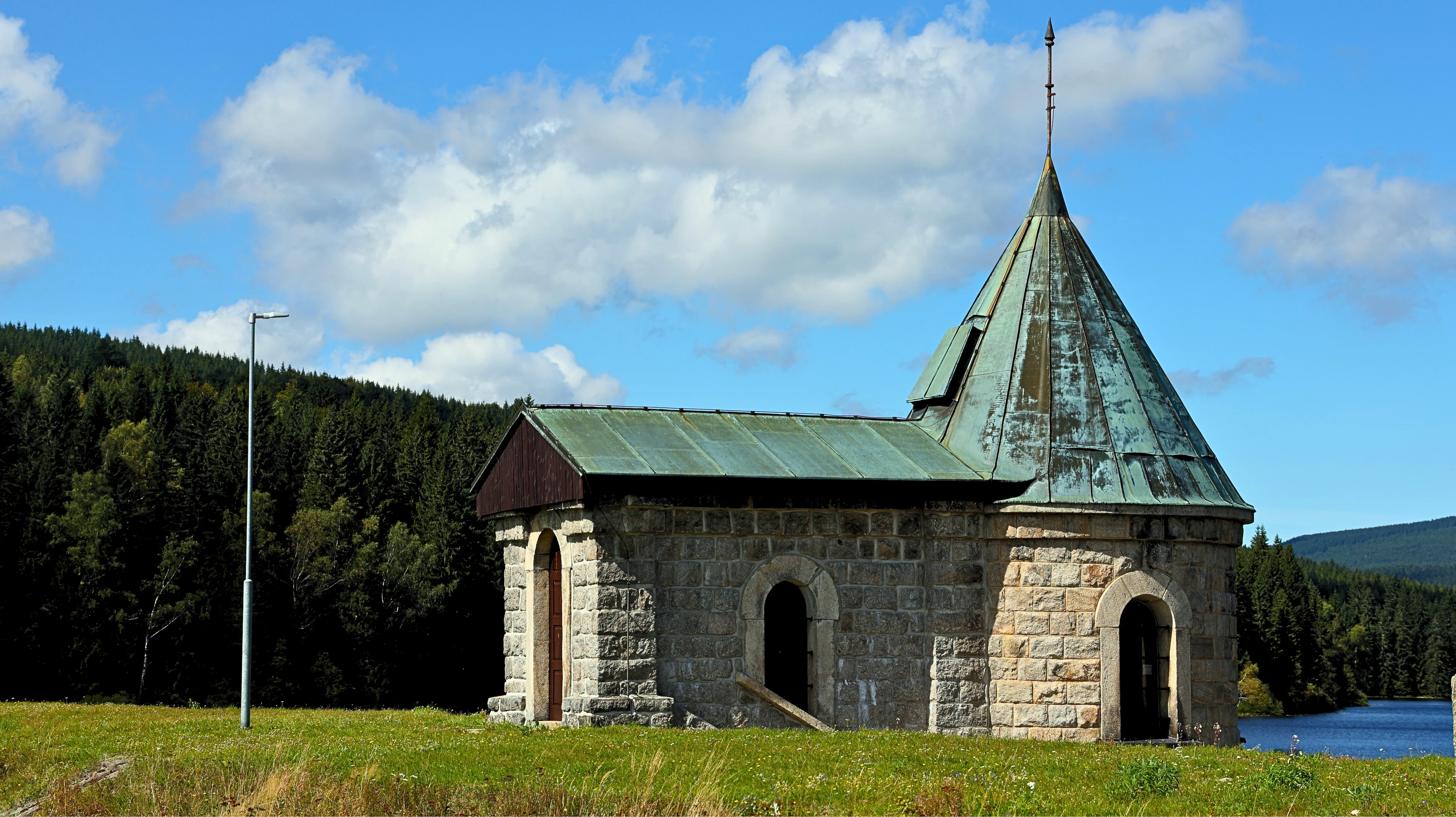
The reinforced concrete water tower on the dam of the Souš reservoir resembles a small church, but in reality it is designed to draw water from two heights. | Photo: admin.
One of the most beautiful places in the Jizera Mountains is hidden beneath the Souš reservoir. In a deeply cut valley, a mountain stream creates beautiful scenery of waterfalls, rapids, cascades, rock pots, and slabs.
It is good that the area along the river has been a protected natural monument since 2013, as it is a unique collection of formations in the entire Jizera Mountains, formed from the end of the Ice Age to the present day.
Monument
The protected area covers 2.23 hectares between the weir retaining water for the small hydroelectric power plant below and the former bridge to the village of Novina.
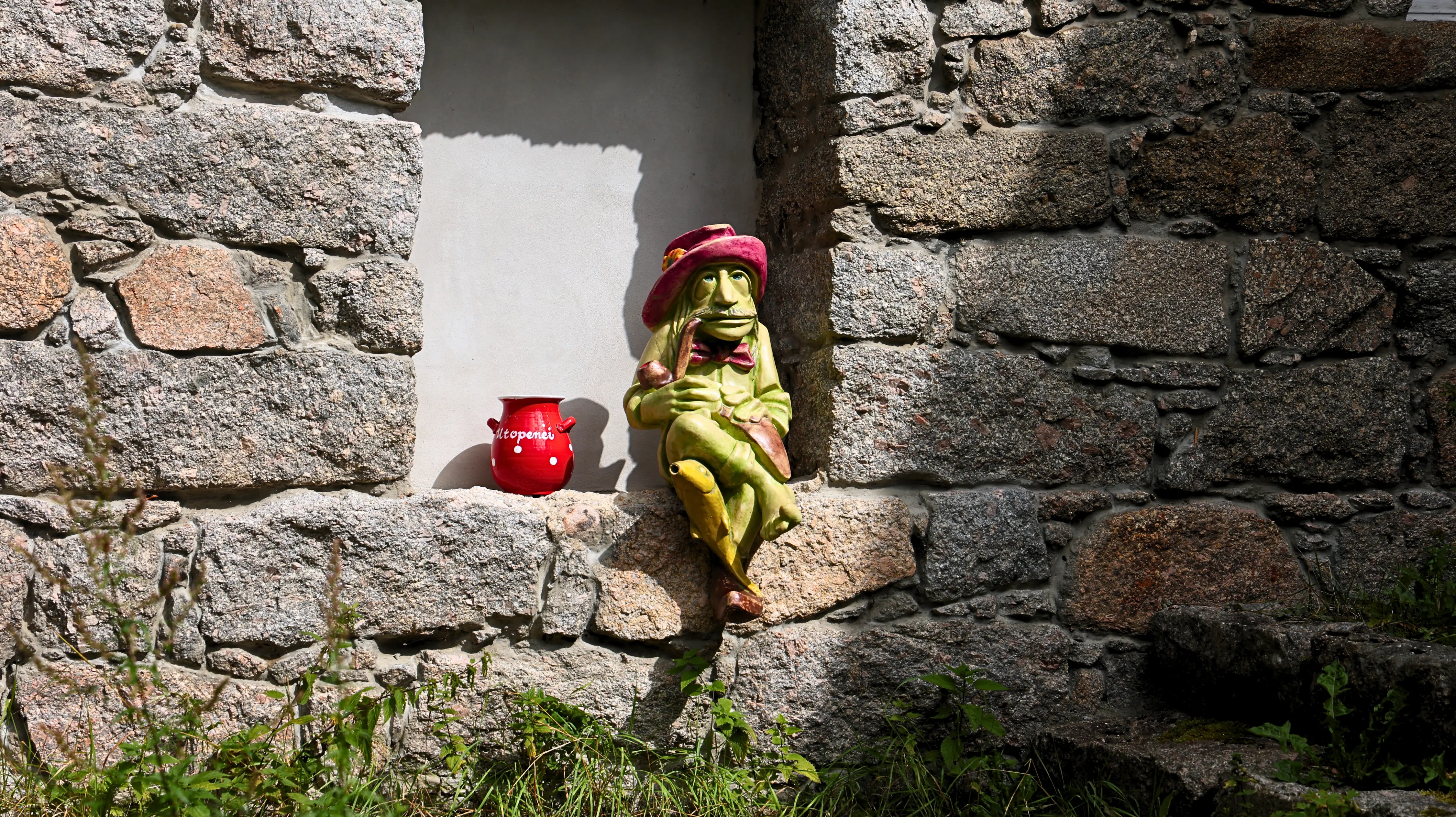
Wherever there is water in our country, the water sprite cannot be missing. You will find him near the houses above the waterfalls. | Photo: admin.
At an altitude of 585-685 meters and a length of approximately 600 meters, the water in the river has a considerable gradient. To give you an idea, this is a slope of almost 17%, which would require a warning sign on the road indicating a steep descent.
The area has a rather rich flora (for example Cicerbita alpina, commonly known as the alpine sow-thistle or alpine blue-sow-thistle, and Homogyne alpina, the Alpine coltsfoot or purple colt's-foot) as well as endangered plant species (for example Huperzia selago, the northern firmoss or fir clubmoss) and fauna (for example the grey wagtail (Motacilla cinerea)).
So far, I have only been lucky enough to see white wagtails in their so-called wedding dress. It is probably impossible to mistake them, as they are characterized by their constant tail wagging.
The attached photo of a wagtail (about the size of a sparrow) is enlarged, so it is not the sharpest. But recently, it unexpectedly kept me company for about fifteen minutes, restlessly hopping and flying around me. So I finally took a photo of it.
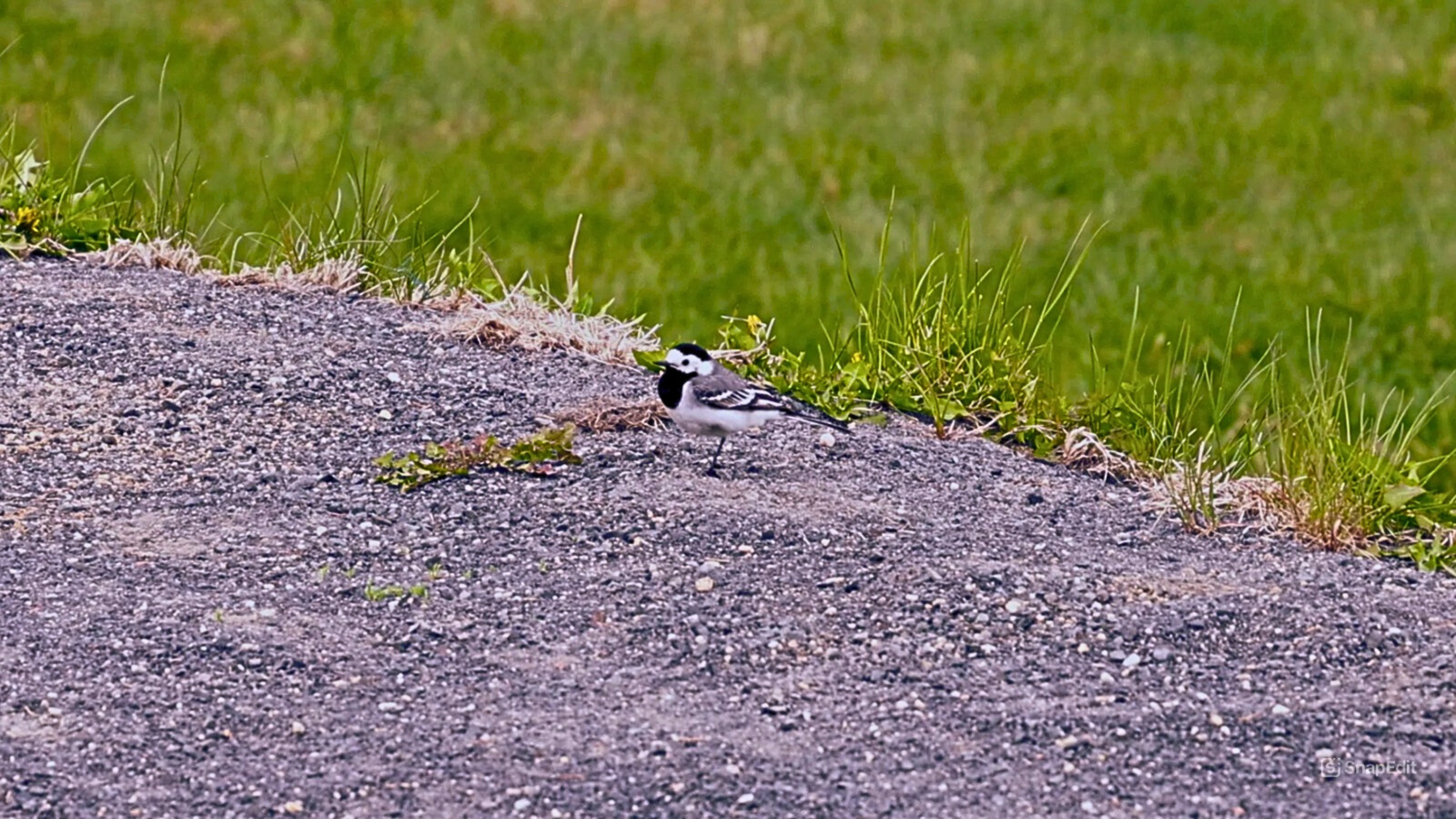
White wagtail (Motacilla alba) in breeding plumage, May 2025. | Photo: admin.
Red tourist trail
It runs quite close to the river and can be incorporated into a longer route. Nature lovers will find plenty to enjoy here all day long. In good weather, it is not unusual to see people sitting by the waterfalls, enjoying the sound of the water and the spray.
It is often recommended to walk upstream from Desná to the Souš reservoir and look for the waterfalls. However, my recommendation is the opposite. Drive to the parking lot at the dam. It will cost you CZK 100 for the whole day, and there is also a small snack bar.
Walk down the path from the parking lot below the main road to the bridge and turn left. Before the red tourist trail connects to Černá Desná, there is a small beach and a natural wading pool. An unmarked path leads through here (see map). Then continue slowly downhill and listen to the waterfalls and cascades.
As long as I live, I will hear the waterfalls, birds, and wind singing.
John Muir (1838–1914), American naturalist, wilderness conservationist, writer, environmental philosopher, botanist,
zoologist, glaciologist, and one of the first advocates of nature conservation in the United States.
There are more of them than the maps show, but not all of them are that big. You can carefully walk down to the river almost anywhere, and all you have to do is look carefully and enjoy. This way, you can easily spend the whole day in nature.
Plus, it's fun to walk down to the river following the sound and only find out what you've discovered when you get to the water. And on the way back up, you can enjoy the waterfalls like a connoisseur.
Legend: 1. Start (Finish) at the parking lot → 2. small bridge → 3. small natural beach and wading pool → waterfalls, rapids, and cascades → 4. Desná information center → waterfalls, rapids, and cascades again → 5. Finish (Start) at the parking lot
The amount of water in the river is regulated (the flow is approximately 500 liters per second, which is not insignificant), but there are days when there is an abundance of water (typically during the thaw) and much more water flows through the riverbed. And that is quite a roar and a sight to behold.
Waterfalls
There are four main ones and then others.
Hrncový - next to a three-meter waterfall with a 60° slope, you can see a granite pot with a diameter of over half a meter, created by the water flow, which is one of the most perfect in our country.
Bukový - is over three and a half meters high and named after the surrounding beech trees.
Dlouhý - with many cascades and rapids, with a large and especially deep pool, reaches an impressive eleven meters.
Plotnový - begins at the edge of a twenty-meter-long rock slab. It is about four meters high.
And other unnamed ones.
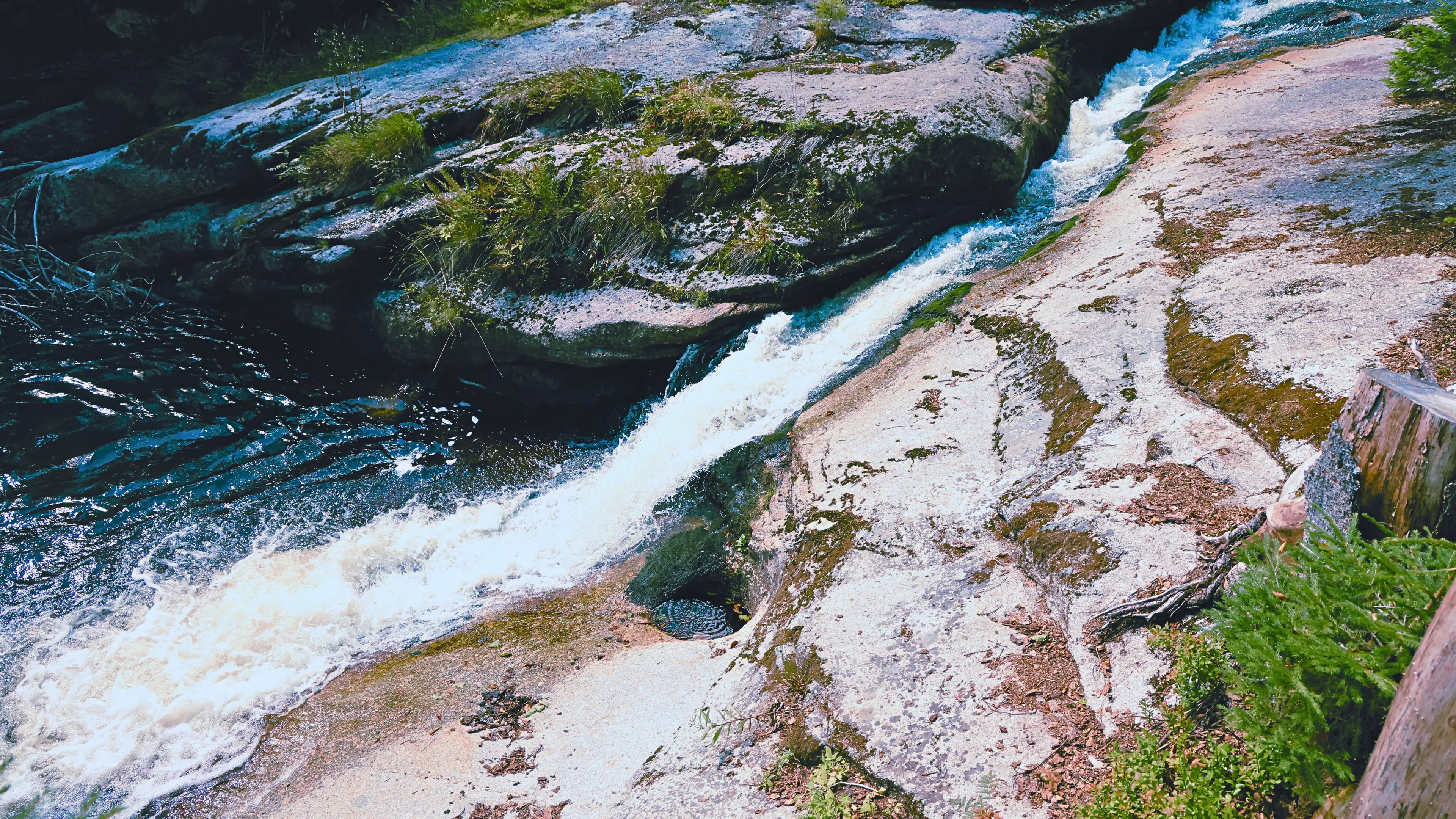
Pot at the waterfall on the left side of the stream. | Photo: admin.
And then there is one more waterfall, which I started calling
-
X (Elon Musk's waterfall).
If you don't know, Musk is obsessed with using the letter X. And there really is such a waterfall here. You can see it in the video.
Video
It is less than 3.5 minutes long and will quickly show you this unique natural monument.

Surrounding landscape
Here you will find rock formations and granite boulders. Here, as well as throughout the Jizera Mountains, I encountered (especially in spring) very cold temperatures in the valleys and distinctly warm temperatures in the higher parts of the mountains.
Souš Reservoir
Don't forget that it serves as a flood control reservoir and is a source of drinking water. Therefore, swimming in the reservoir is prohibited.
I wish everyone a good trip, great views, and nice weather.
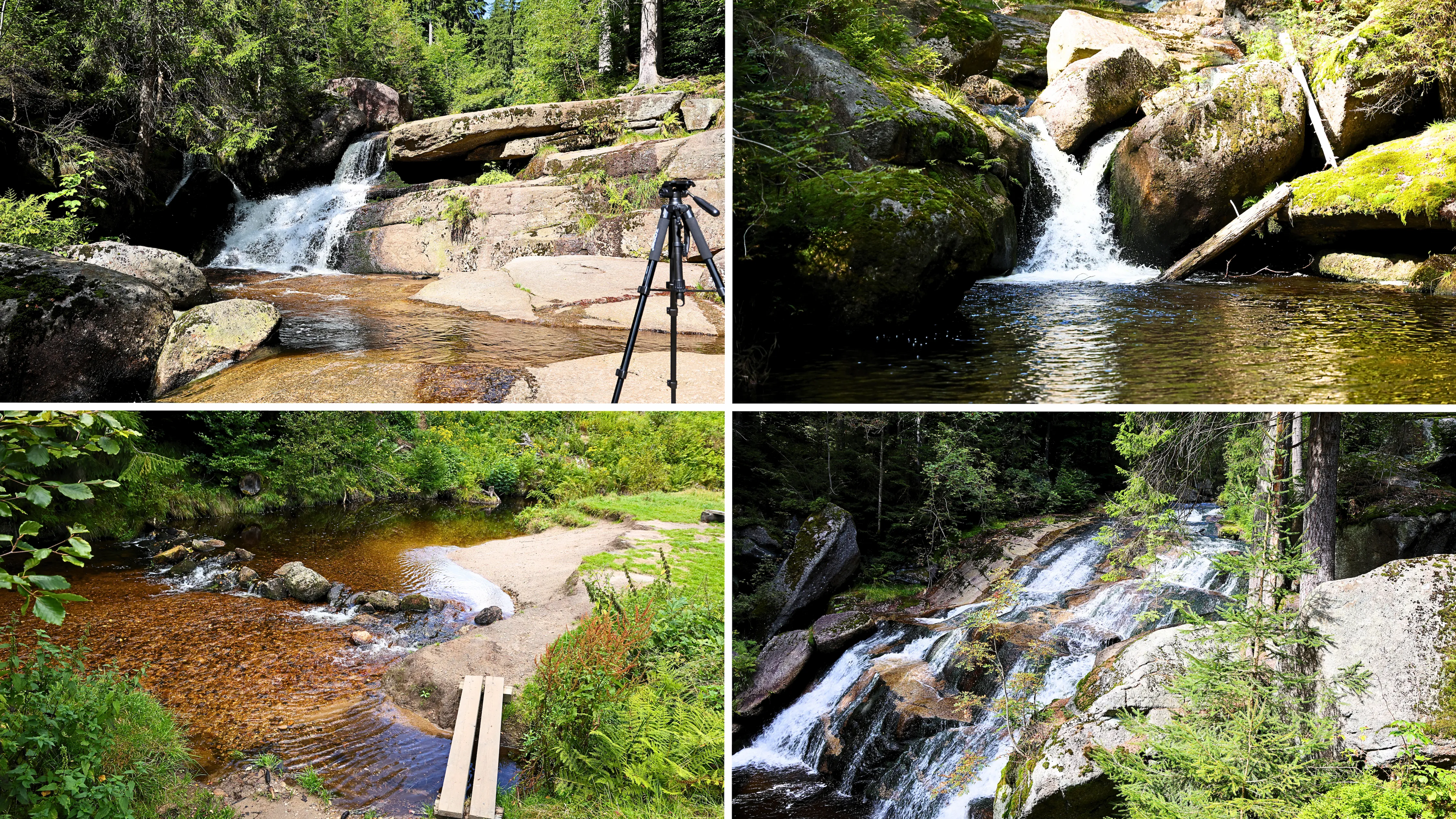
1. Plotnový Waterfall. | 2. X (Elon Musk Waterfall - unofficial name, that's just what I call it) | 3. Natural wading pool and beach above the waterfalls. | 4. Long Waterfall. | Photo: admin.
Weather forecast for the trip area
The Souš water reservoirs are right in the middle of the map.
Even children can manage the trail, but you have to watch the little ones near the water. Especially when descending to the river or waterfalls.
You can also cool off at the waterfalls, but the rocks are slippery in places, and even ten centimeters of water can be powerful